January 2015!

Not the scenery we expected in northern Tanzania!
For the last few days of 2014 and New Year 2015 we stayed in the (relatively!) civilised environment of Arusha in northern Tanzania. This is the base from which most tourists start/end their safaris in the Serengeti, so it has all ‘mod-con’ facilities that an overlander could want: well-stocked shops, well-appointed campsites and for Cuthbert – a registered Iveco Service Centre! Yes, it’s time for Cuthbert to have his 40,000 km check-up and we made an appointment for him with Dr. Iveco.
We can’t report that the Arusha Iveco Service Centre is exceptionally well equipped, but the chaps there were helpful and cheerful and did what they could with the limited tools at their disposal. Fortunately, in anticipation of such situations arising in Africa, we had brought with us from UK a spare supply of the correct oil, fuel and air filters for Cuthbert (including most of the necessary specialist tools!).
So after a morning in the Arusha workshop, Cuthbert was signed-off with a clean bill of health and was good to go for another 40,000 km. “Marvellous!” we thought…. until a few km down the road the car behind us started beeping urgently, bystanders at the side of the road started pointing and shouting, shortly followed by Cuthbert shutting down his engine and displaying various ‘Error’ signals on the dashboard. Oh noooo….!
Marcus jumped out the cab and saw a dribble trail of liquid on the road running back far behind us! He opened the bonnet to find that the fuel pipe had become disconnected from the fuel filter out-put, and was pumping diesel all over the engine and dripping onto the road. Rather comically, a local chap at the side of the road had spotted the leaking fuel and was running behind us with a container trying (unsuccessfully) to collect the discharging fuel before it soaked away into the tarmac. Marcus managed to stem the flow of fuel and reconnect the pipe, which it seems had not been properly attached after it was cleaned during the Service. Luckily not too much fuel was lost, so disaster averted…. phew!

Party People!
During our stay in Arusha it was great to be able to introduce Cuthbert to some good friends of ours who were visiting from UK. With Mark, Anna and Freya we had two occasions to celebrate: first, a belated celebration for Anna becoming a Professor at Oxford University in 2014 – Congratulations Professor Gloyn!! (we don’t really understand all the sciencey stuff that you do, but are sure the new title is well deserved 🙂 ).
Secondly, we celebrated New Year’s Eve at a fun (but slightly bizarre) party in a local hotel. Party-girl Freya was a star dancer with a fabulous demonstration of her skills gained from watching a recent season of ‘Strictly Come Dancing’ on TV in UK 🙂 . Unfortunately we didn’t win any of the rather curious raffle prizes, one of which was not one, but two medical evacuations with the local air-ambulance service (hmmm… not sure which (un)lucky party-goer benefitted from that particular opportunity!) Anyway, notwithstanding the shall we say… ‘slightly unconventional‘ entertainment laid-on for the event, the evening was a big success. We all had a great time and it was lovely to catch up with some old friends.

Under the new policy… an expensive view!
On New Year’s Day we said farewell to Mark, Anna and Freya and headed east past Moshi to Lake Chala – a crater lake on the Kenyan border. On the way we were surprised to pass through acres of beautiful sunflowers blowing around in the wind – not a crop commonly associated with the safari lands of northern Tanzania! Photo-opportunity (see above)!
Dusk was falling as we arrived at the lake, but we could still see the view over the crater and just about make out Kilimanjaro on the skyline to the north. Even better… there was a pleasant-looking bar/restaurant in which to relax with a beer to enjoy the view. “Nice!” we thought! We could stay here for a couple of days and do a bit of hiking around the area.

Kilimanjaro… again!
As we parked Cuthbert and set up for the night, the camp warden approached to inform us that under a new government policy, there is now an entry fee to see the lake. Instead of the previous US$10 per person for camping, the cost is now an extortionate US$80 for the two of us to camp there for one night! Excuse me??? We received an official receipt for the fee, so we are confident that (unlike some other spurious charges in Africa) the money does go to official sources rather than the officer’s pocket. The lady in the restaurant was apologetic, explaining that the new edict from Dar Es Salaam was introduced recently and was affecting her business. It is sad that a short-sighted policy to make a fast-buck from tourists is causing local businesses to suffer. Had it not been for the new fee, we would have stayed at the campsite for a few days and provided custom for the bar and restaurant. It will surely not be long before jobs are lost and the local economy suffers seriously due to this short-sighted new policy.
 After a short hike in the morning at Lake Chala, we headed on towards the Usambara Mountains, some 200ish km to the south. This is reported to be very scenic part of eastern Tanzania and the back-road, up the north side of the ridge to Mtae, is meant to be particularly spectacular. This route up is noted to be strictly for 4x4s, but should hopefully be no problem for Cuthbert.

One of the neighbours at Mambo View
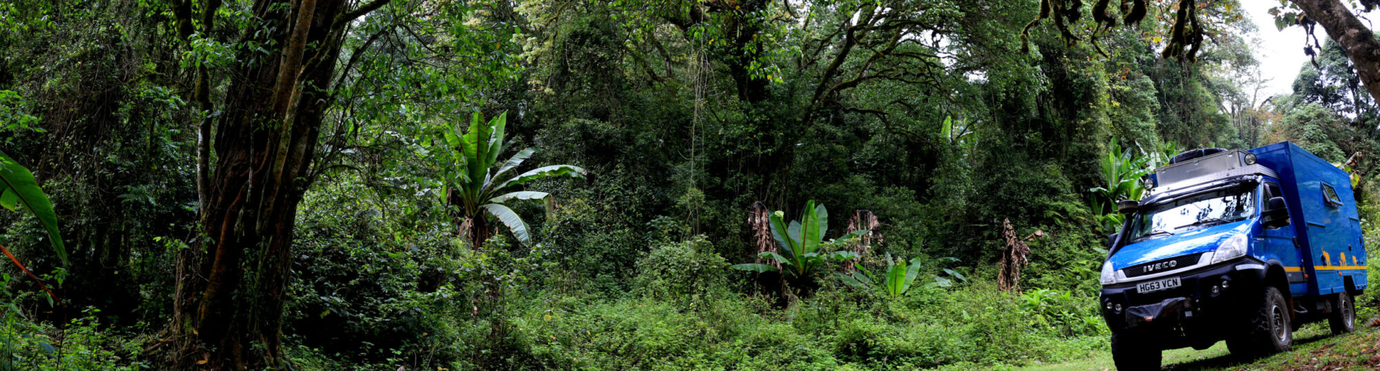
The extremely rough track initially followed the flat valley, then suddenly climbed steeply in a long series of tight hair-pin bends. The surface is washed away in crevices forming deep gorges in places; and the sections that aren’t washed away are frequently strewn with loose rock-fall. From the start of the main ascent to cresting over the top of the escarpment is only 4km, but in that distance the road climbs 1,200m in altitude. The gradient was over 45° in places, but with diff-locks engaged and low-ratio gears selected in the worst sections, Cuthbert performed admirably. He chugged slowly and steadily, rocking around on his air-suspension over the rough ground all the way up to the top! Awesome chap 🙂 . The locals in the first settlement that we came to on the top, looked on in mixed amusement/amazement as we crested over the ridge-line into their village high-street; we guess that they don’t see vehicles of Cuthbert’s size climbing the escarpment every day.

Cuthbert is up there on the top at Mambo View!
Once on the top we headed for Mambo View Camp: a lovely spot, clinging to the edge of the cliffs and with spectacular outlook over the valleys and plains below. The eco-lodge there is run by a Dutch couple with a strong ethos of supporting the local community and is highly recommended if you happen to be passing by sometime! At around 6,200ft the climate is pleasantly cool and perfect for taking some hikes around the stunning countryside. The Usambara Mountains apparently hosts a unique eco-system with several species of birds, insects and plants not found anywhere else in the world; we were chuffed and very fortunate to spot a rare Horned Chameleon in the bushes as we were out walking.
 Moving on south, we continued on the back-roads through yet more beautiful scenery of the Usambara Mountains to Lushoto and Irente View. This area is far more touristy than around Mambo and Mtae in the north of the mountain range. As it is far more accessible from the main Dar-Arusha highway, it is much more visited by ‘mzungus’ and consequently difficult to avoid constant approaches from local ‘guides’ wanting to show you around the area. The route from Mambo to Lushoto and then onwards past Soni to the main highway is winding and descends steeply in places, but it is a graded gravel road and definitely a ‘walk in the park’ compared to the mammoth route that Cuthbert climbed up to Mambo a few days ago!!
We generally don’t do much planning ahead for this travelling lark; preferring more to make it up from day-to-day as we go along. However as we head south from the mountains down to the Indian Ocean coast, we do have a general ‘big picture’ of getting back to South Africa to ship-out before mid-May (when Cuthbert’s Carnet expires). Our approximate route is to head south down the eastern side of Tanzania and cross into northern Mozambique, which we must do before our Tanzanian visa expires.
Part 1 of the plan is to stop at the Mozambique Embassy in Dar Es Salaam on the way south and obtain visas. This should hopefully not be too problematic, but we have heard that crossing the Ruvuma River (which forms the border between Tanz and Moz) may not be quite so simple.
We understand that there are two options to cross the river: (i) ‘ferry’ at Kilando on the coast near the river-mouth; or (ii) the new ‘Unity Bridge’ inland at Negomano. Both sound fine don’t they? Well they sound fine until you dig a bit deeper….

Nice beach to relax whilst we ponder the Moz Options
Regarding ‘Option: Ferry’ – we have read several slightly worrying stories, ranging from a large 7-car vessel (described in one source as “decidedly iffy” and another source as “sunk”!) becoming lodged on sandbanks mid-river for several days, to a tiny boat carrying 1 car at a time, being capsized by hippos mid-stream! Research on the internet has revealed anecdotes and pictures of an over-landing 4×4 vehicle balancing precariously on four fishing canoes being floated across the river. We have a certain sense of adventure travelling across Africa, but this does not stretch to trusting a few local fishermen to balance our precious 6 tonne Cuthbert on some dug-out tree-trunks to cross a fast-flowing hippo and croc infested river-delta! Cuthbert’s insurers are unlikely to look favourably on any claim that arose in these circumstances, so we’ll be giving that potential opportunity a miss! There does not seem to be any authoritative source of information about crossing the river border here and it is hard to work out which, if any, of the anecdotes on the internet reflect the current state of affairs.
Regarding ‘Option: Unity Bridge’- we have heard that this crossing was completed in 2010 some 350 km in-land from the coast. However the ‘rocket scientists’ on either side of the border who jointly planned and authorised the construction of this marvellous piece of civil engineering, failed to authorise any proper link-roads to get to or from the Unity Bridge from the main roads. It was apparently located not (as you may reasonably expect) to link any established routes of communication between the two countries; it was apparently located to commemorate a historic and remote point at which some revolutionaries swam across the river to escape capture. It seems that no surfaced roads have been constructed on either side of the river-border to reach the remote new bridge; on both sides there are many, many miles of rough dirt-road linking the two very minor and strategically insignificant towns. For most of the year this dirt-road is apparently a long, rough track for which a 4×4 is preferable on both sides of the border. But in the rainy season (i.e. around now!) these ‘roads’ can become quagmire swamps, frequently littered with (and sometimes blocked by) lorries stuck up to their axles in mud.
So, dear Cuthbert follower…. which Option would you choose to head towards to cross the river? The ferry or the Unity Bridge? Answers on a post-card please, to: Cuthbert Tuck, Northern Tanzania, Africa 🙂


It’s Hell here…
From the highlands we descended some 1,000m to the main Dar – Arusa highway, leaving behind the pleasant 18°C of the Usambara Mountains. On the way down, the outside air temperature rose steadily and by the time we reached the Indian Ocean coast near Tanga, it was around 35°C with over 80% humidity. Before we even caught a glimpse of the ocean, we could smell the salt in the sea-air blasting in through Cuthbert’s open windows.

Cuthbert – chillin’ near Pangani
We found a great campsite on the beach between Tanga and Pangani and it was terrific to be back by the ocean again – parking Cuthbert on the sand and falling asleep at night to the sound of the waves crashing nearby. Over the last few months we have camped on some wonderful beaches of fresh-water lakes, but Cuthbert was now back on the ‘proper’ coast! We had not seen the sea since leaving Namibia’s Skeleton Coast on the South Atlantic ocean back in July last year, and we had not seen the Indian Ocean since one very stormy day at Cape Agulhas in June last year (see Africa’s Bottom – Cape Agulhas).

Fritz’s overlander
After a relaxing week or so on the stunning beaches of Tanzania’s north-east coast, we decided to continue on southwards. We had had some quality beach time and met some nice fellow travellers: a German/Italian couple touring on a BMW motorbike; an Australian family on holiday from Kenya; and an Austrian couple touring in their home-converted ex-military mega-truck! It was all a bit, as the cool dudes say: ‘chill-axing’. In fact over the few days, we chilled-out and relaxed so hard that the ‘Ferry –v- Bridge Dilemma’ (see above) and the time constraint posed by the imminent expiry of our Tanzanian visas slipped our minds! It suddenly dawned on us that we had only a few days left on our Tanzanian visas to drive over 1,000km to the Moz border, and we still had to stop-off in Dar Es Salaam on the way to get our Moz visas. Also there were a few things we wanted to see on the way, so we didn’t want to rush past all the sights of south-eastern Tanzania. Cripes! We’d better get a move on!!
For the drive south to Bagamoyo, we studied our maps and found two route options. We decided that rather than take the main road, which seemed to route a fair distance north before eventually heading south, we would take the short-cut shown on one of our maps. Taking a 50-60km cross-country track from south of Pangani, we could cut the corner and take maybe 150km off the ‘main road’ route. This short-cut was not shown on our GPS (and we can now confirm that there is a good reason for this 🙂 ) but it was on two of our other maps, so it must be ok… surely? Wrong! It was in fact a slow and tortuous ‘expedition’ through a maze network of many, many, little-used narrow and rough tracks. And the vicious camel-thorn spikes in the bushes arching heavily into the road gave poor old Cuthbert’s external paintwork a bit (more) of a bashing 🙁 !

Acres of sisal plantations – scenery for the “short-cut”
After almost 8 months in Africa, we are now well accustomed to making our way across countryside with a total absence of any signposts – they are extremely rare. But what was critically different in this case was that Wallace our GPS, showed us navigating across a giant blank space on the screen. On the ground, junction after junction offered us a series of un-signposted route options which we had to take by trial and error. Often the route appeared initially to be heading the right way, but then some miles later, turned through 90° and diverted in totally the wrong direction. Another basic error that we made (“It seemed like a good idea at the time, Guv!”) was to follow directions offered by a Maasai chap at the side of the road. We have never done this before and on this occasion we did it with some reluctance, but we hoped that local advice might take some of the guess-work out of the route-finding (note to self: placing faith in an African villager regarding his situational awareness of his wider geographical location, is usually a bad idea).
Almost 5 hrs after setting off on the ‘short-cut’, we finally emerged onto the main highway, only around 50km from where we had started! Oh well… all part of the African adventure! Putting a positive spin on it… the alternative was 150km of boring tarmac highway! At least we had an interesting, if a slightly testing day 🙂 .
Dar de dah dah dah – the visa story
After the tale above, you probably won’t be surprised to learn that we eventually rolled into Bagamoyo rather later that afternoon than anticipated. This small town is notorious for having been a major port for the gruesome slave trade in the 1800s. It was also the port from which Livingstone’s body made its final voyage out of Africa for burial in UK. As we drove through the town to reach the campsite it looked an interesting place with narrow streets of colonial style architecture. We looked forward to going back to the historic centre in the morning for a wander around.
Unfortunately the next morning was marred by torrential rain. The heavy grey clouds looked well set-in for the day, so we reluctantly had to skip our planned tour of Bagmoyo’s attractions and proceed on to Dar Es Salaam (aka ‘Dar’ to his chums). Our plan was to camp on the Sunday night as close to Dar city centre as possible, so that we could be at the Mozambique High Commission when it opened first thing on Monday morning.

Dar Es Salaam – friendly policeman curios to see inside Cuthbert
Monday started well. We went into town early to avoid the commuter rush and to secure a parking space close to the High Commission. As we sat having our breakfast in Cuthbert, the town seemed remarkably slow to spring to life. Did no-one come to work in Dar???? Turns out it was a Public Holiday celebrating some historic revolution or other. Ah! That will be why it’s quiet then! The impromptu day off gave us chance to see the few sights of Dar, but set us back precious time on our schedule to get to Moz before our Tanz visas expire (note for anyone wondering why we didn’t just extend our Tanz visas: that may be a fall-back option, but we have heard that it is not as simple in Tanz as it is in other countries. If we could manage without doing this, it would probably save us a day sitting around the Immigration Department offices waiting for the officials to decide whether we are worthy).
The Tuesday morning traffic into town was predictably busier. We still arrived in time for opening, but the two hour commute (which had taken only 20 mins the day before) set the pace for a long and mind-numbing day in the Mozambique High Commission. To (mis)quote a great man: ‘Never in the field of visa issuing, has there been so much senseless bureaucracy by so many apathetic and incompetent clerks to so few travellers!’ Our pain was alleviated partially by sharing the experience with a Dutch/Portugese couple going through the same process, but having even greater difficulty with the visa bureaucracy than us: they are planning to sail their yacht from Dar down to Pemba.
The memory is still too painful for us relate the full story here (and we couldn’t inflict such tedium on any loyal Cuthbert followers) 🙂 , but by the end of the day we were back at the campsite, US$100 lighter in each of our wallets but relieved to have the shiny new visa covering a page in our passports.
“To Moz or not to Moz?” That, is the question!
That evening, having celebrated and rejoiced our gaining the Mozambique visas, we planned our approximate route through northern Moz and across to Blantyre in southern Malawi, crossing the border at Mount Mulanje. It was now decision time for the Ruvuma River crossing: ferry or unity bridge? We finally decided on ……drumroll please … the ferry!
Our decision was assisted by an email we had received from our Japanese traveller friend, Rika who was ahead of us by a few days and had reached the crossing. She explained that the 7-car ferry was running well and we shouldn’t have any problems with Cuthbert. Unfortunately for her however, the muddy road was proving too difficult for her car. With no 4-wheel drive to cope with the road conditions, she would have to retrace her steps 600km all the way back north to Dar Es Salaam and take an alternative route south through Malawi on tarred roads. This is such a shame for Rika! We know she was very much looking forward to Moz, but in the rains it seems she doesn’t have any choice 🙁 . Anyway, the mud road should not be a problem for a truck of Cuthbert’s talents, so we went to bed with happy thoughts of the forthcoming adventure.

News picture: current state of the Moz roads
Next morning we awoke bright and early and did our usual check of the local and international news on-line. Both the BBC and African sources had new reports of flood problems in north-central Mozambique and southern Malawi. We delved a little deeper into the stories; it can’t be that bad… surely? We spent a few hours on-line researching further with other sources and it wasn’t looking good. Between the two countries, thousands of families had been displaced with their villages washed away and over 50 people had died due to the flash-flood conditions. Both governments had issued Amber Alert warnings for the key areas that we had to pass through. The rainfall level in the region was around 150% of its seasonal norm, and rivers that normally in the rainy season rise by 6m, had risen by over 12m. Perhaps most critically for our planned route, the bridge over the River Licungo had apparently been washed away near Mocuba, so northern Moz had been totally cut off from the centre and south of the country, with vehicles stranded on either side.

Another news picture: Cuthbert has a good wading depth, but even he couldn’t ford through this flooded valley!
We studied the maps and Google Earth again in detail, desperately searching for a route that avoids the disaster zones and which might be passable for Cuthbert. Disappointingly, we found nothing of any use to us. The rivers in Mozambique have very few crossing points and these are crucial to the national transport infrastructure. Surely then, they would be promptly repaired we thought; but our on-line research indicated that in previous years it had taken several weeks to repair other critical bridges that had been washed away. And even if they are repaired promptly this time, the final ‘nail in the coffin’ of our plans is a cyclone building off-shore between Mozambique and Madagascar bringing further potential destruction to the coastal area over the next couple of weeks.
We were gutted as it became clear that Cuthbert’s northern Moz thing is really not going to work out. But putting things into perspective – our problems are nothing compared to the far more serious suffering of the poor people living in the affected areas. Our Mozambique visas have not gone to waste – we can still enter the country when we get further south. We will simply have to move west and find a detour route south through Malawi or Zambia. Flexibility… love it 🙂 !
With great reluctance and sadness at having to skip our much anticipated northern Moz section of the trip, we set off on the long drive across southern Tanzania on the Trans-African highway from Dar to Mbeya.
The 700km stretch of highway is a route well-trodden by the (many) large overlanding trucks carrying gap-year students on their whistle-stop tours of Africa. It is also a more easterly section of the same fearful Trans-African highway that we had driven 3 months ago (see Highway from Hell), so the thought of this drive did not fill us with unbridled joy. In addition to the suicidal lorry drivers, we had heard discouraging stories from other travellers of regular ‘speed traps’ and questionable ‘fines’ by corrupt police. At the time, we listened to these stories rather smuggly, confident that our routing south through Mozambique would allow us to avoid the tedium of this travellers ‘rat-run’!! Oh how wrong we were 🙁 !

One of the many…
As we had feared, the kamikaze lorry and bus drivers were scary, with their excessive speeds and poorly maintained vehicles overtaking on blind-beds. We saw many overturned trucks in the verges along the way. However the scenery through much of the journey is very pleasant and the road passes through the middle of Mikumi National Park, with some critter-spotting opportunities (giraffes, ellies etc) from the main highway. Cuthbert suffered only one speeding fine, which was probably unjustly awarded (allegedly doing 56kph in a 50kph zone) but it was only Tsh30,000 (around £11), an official receipt was issued and no bribes were sought. This being Cuthbert’s first police fine in 8 months of driving around Africa – it is not such a bad record!
Along the route there are some very nice stops: we would particularly recommend Neema Craft Centre and Café in Iringa and just south of Iringa is a great camp at Kizolanza Farm. The restaurant there serves some of the best food we have had in Africa – mostly fresh produce grown on the farm – and it is here that we met the amazing British/South African couple Philip and Fran.

Winners of Cuthbert’s Award for ‘Most Intrepid Travellers’
They had been overlanding for the same 8 months that we had been on the road. But in the same time that it had taken us to do a loop half-way up Africa in Cuthbert, they had travelled all the way from China, across central Asia, into Europe, then south through Egypt, Sudan and down the east side of Africa. Not only had they covered all this distance in 8 months, but they had done it on bicycles!!!! Yes, you read correctly – bicycles (those things with two wheels that require human effort to cover every metre of planet they cross). They cover on average 100km each day and plan to end their journey in Cape Town in a few weeks’ time.
Regular Cuthbert followers will have seen our occasional tales in this blog of overlanding motorcyclists and other travellers far more adventurous than us on our luxury Cuthbert-tour, but Philip and Fran certainly win Cuthbert’s Award for ‘Most Intrepid Travellers’ of our trip. We take our hats off (and Cuthbert tips his roof-hatch 🙂 ) to this inspirational young couple who are doing this journey together for the first year of their married life! You can see their story-blog at http://detouring.org/about/

Seems like a good place to ponder… Malawi or Zambia?
Since taking the decision to detour around northern Mozambique, we have been checking the international and regional news for updates – just to be sure that we didn’t act too hastily and find out that the problems had all been resolved! We found that, on the contrary, things seem to be getting worse. The torrential rain is continuing, the rivers/floods are still rising and there are various coach loads of people stranded for two days now, sleeping on the buses and running out of food. Hmmm… looks like we made the right decision! But having now made it all the way across Tanzania and approach the junction at Mbeya, we need to decide (flip a coin?) which route we will take as an alternative to Mozambique: head south and retrace our steps back through Malawi, or continue west into Zambia.

Marcus trying to catch our supper (we had omelette instead 🙂 )
We can see pros and cons to each of the options, but in the end we chose Malawi. Our arguably irrational 🙂 views on Zambia haven’t softened (see Moving on… ) and although we are reluctant to go back down a route we have travelled just a few months ago, we are aiming to enter Mozambique further south when the floods are less severe, so the more easterly route suits us best.
Here is our final route map for the whole of Tanzania. The red line up the west is our route from south to north (Malawi to Rwanda), the red line down the east is our route back south (Kenya to Malawi). Our original plan to head all the way down the eastern coast to Mozambique was thwarted by floods and washed-away roads (see above ‘To Moz or not to Moz?‘). The blue line in the middle is the GPS track of a previous trip that we did to Tanzania in a hired Land Rover in 2013.
So Cuthbert is now heading back to Malawi. We did after all, establish on our first visit to the country that there is MTMTMK 🙂 (see So is there MTMTMK?). Click here for the new ‘Return to Malawi’ page to continue the tales Cuthbert’s adventure….