February 2015
 Crossing the border from Mozambique into Zimbabwe, one though struck us…. Why is it that a Zimbabwean immigration officer can process and issue a tourist visa within 15 minutes ‘on-the-spot’ at the border and with a smile, whilst his humourless Mozambican equivalent requires a full day of tortuous bureaucratic procedure at an embassy office???? Just sayin’…!! 🙂
Anyway… we were pleased to be back in Zimbabwe. We had really enjoyed a few weeks here last year (see Zimbabwe) and were blown-away by how friendly the people are! Nowhere that we have been in Africa, have the people been nicer or more welcoming than here in Zimbabwe. Had we just been lucky with the people we met? Or were Zimbabweans particularly friendly only in the west side of the country? This time, now touring the renowned Eastern Highlands, we would find answers to these critical questions and more.
Having entered Zim a bit further north than we originally expected, we found ourselves on an impromptu stop-over in Harare. This is a city not on many people’s Top 10 hit-list of ‘must-see’ destinations, but it was an interesting de-tour and not as awful as we had expected. Yes, the city centre has crumbling streets and pavements that have clearly seen far better days. And yes, there are a great number of hideous 1960/70s concrete monstrosity edifices from the city’s former hey-day as ‘the’ place to be in southern Africa. But these disintegrating monuments of the Mugabe era are partly what make this such a curious and fascinating place. They will hopefully, in the not too distant future, be assigned to the bin of history and we will be able to return one day and witness the changes for the better.

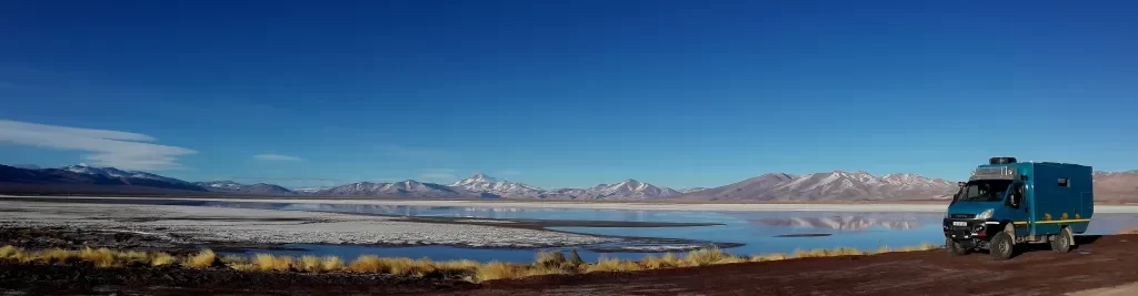
Heading south: total gridlock – Zim style
And it’s not all ‘doom and gloom’ on the streets of Harare. Despite the physical decay, there is a buzzing vibe about the city centre on a busy Saturday shopping morning. There are some well-kept, affluent suburbs (we guess probably inhabited by Mugabe’s cronies) and the range of shops and restaurants is best we have seen since Nairobi. We couldn’t recommend it as a highlight of an Africa overland trip, but for anyone like us, fortunate enough to have the time to take in the ‘warts and all’ aspects of the countries visited, it is a worthwhile detour to see another side of the country.
To provide you with some illustration of our point, we would have liked to have taken some photos of the city’s ‘glorious’ concrete monstrosities, but unfortunately we didn’t feel safe to wander around displaying an expensive digital SLR camera. This is not a derogatory observation of the city; we are sure the crime level here is better than many other African cities and probably no worse than many major cities in the west. But common sense tells us that to wander around the streets of a poor inner-city in a disadvantaged nation, displaying a camera worth probably more than a year’s wages to most of the people, is not the brightest of travel activities. We are sure that with the wonder of the inter-web, your good friend Mr Google can show you some enlightening examples of Harare architecture if you would like to see them for yourself 🙂 .
Getting into the Eastern Highlands

The first of many stunning scenes!
Some way south of Harare begins the Eastern Highlands of Zimbabwe, running north/south along the Mozambique border. We have heard much about this area from other travellers and from our friends Peter and Heike who travelled here last year with their (Cuthbert sibling) truck, christened: iMobil. It is apparently a beautiful area, but they warned us of a few lanes featuring one of Cuthbert’s few weaknesses… low branches! The chain of attractions threads from the northern section around Nyanga National Park, down to a central section of Bvumba Mountains near Mutare, and finally a southern section around Chimanimani.
We first stayed a few days in the northern part of the highlands in the Troutbeck area and Nyanga National Park. Cecil Rhodes had one of his favourite holiday homes here and the park was bequeathed by him to the nation when he died. Here we met Tom and Anuk, a friendly young Dutch couple taking a year out of their early careers to: (a) drive around Africa; and (b) teach us the Dutch way to play (and get soundly beaten at) Gin Rummy!
Moving south a bit, the next area of the Eastern Highlands is the beautiful Bvumba Mountains where we parked up for a couple of days to enjoy some walks and fabulous cakes in the legendary ‘Tony’s Coffee Shop’ (some serious hill-walking was required to burn-off the calories in that delicious white chocolate cheesecake with raspberry sauce and whipped cream!!).

Posh place – Queen Mum woz ‘ere
The Bvumba Mountains area was for many years a favourite holiday destination of wealthy southern Africans and it has some of Zimbabwe’s poshest hotels. Not only did the ‘well-to-do’ of southern Africa come here, but British royalty too! The Queen Mother and Princess Margaret no less, stayed at the Leopard Rock Hotel for a holiday back in the 1950s, famously stating that: “Nowhere in Africa is more beautiful”. Pictures on the hotel walls also show Princess Diana enjoying the facilities… although Charles is nowhere to be seen in the photos!
But despite this illustrious past and the potential for the area to once again thrive as a centre for regional and international tourism, the Bvumba Mountains infrastructure is yet another example of the woeful long-term underinvestment by the government.
It is also a great example of the amazing resourcefulness of the Zimbabwean people, working hard to regain their pride in their once modern nation. The sole access road up to the mountains from the town of Mutare has deteriorated so much that it is now almost un-driveable without a 4×4. The cavernous potholes are being repaired by men toiling in the sun with pick-axes and shovels. It is a rather botched job and the holes in the tarmac are being filled and levelled with rubble and soil from the sides of the road, but the sign on the verge says it all: “Road works by volunteers – Please donate”. This is a great example of the spirit of the Zimbabwean people. Where else in the world do local people go out and freely give their time and hard-slog physical labour to repair their country’s crumbling infrastructure?
Catastrophe has befallen us! We have an official ‘yoghurt crisis’! Diligent followers may recall that some months ago, we learned an incredibly simple way to make fresh yoghurt whilst we are travelling away from ‘civilisation’ (see Yoghurt??? Really???). Unfortunately something went very wrong with our most recent batch: it failed to generate overnight into a fresh new bowl of creamy yoghurt for our breakfast muesli. The coroner has yet to carry out the post-mortem examination to establish the exact cause of the death of the yoghurt culture, but it is no more! Critically, the key part of the yoghurt-making operation is to have a ‘starter culture’ to add to some warm milk. This is usually provided by the last two tablespoons of the previous batch, but obviously if one batch fails, you have no new ‘starter culture’ to create the next batch. The ‘yoghurt-chain’ is broken and can only be re-started with some fresh new ‘starter culture’ yoghurt from a shop. This is the first time, in around 6 months of yoghurt making, that we have suffered such a failure crisis. It will be some time before we are within reach of a shop sufficiently sophisticated to sell fresh natural yoghurt to start again 🙁 .
There are two roads leading south to Chimanimani:
- the main tarmac ‘super-highway’ (incidentally… credit where it is due… although we much malign the Zimbabwean infrastructure and the town/rural roads, the long-distance highways between the main towns are toll-roads and mostly in very good condition); or
- the mountainous, and allegedly very scenic, dirt-track – ‘The Cashel Road’.
 Our guide book warns that this 60km route requires ‘a robust 4×4 and quite a bit of confidence’. Well, we have great confidence in Cuthbert! Our friends Peter and Heike had driven this road in their ‘iMobil’ last year, so we knew that in theory it would be passable for Cuthbert. However they did the route back in August in the dry season. Other overlanders have told us that it would be a different story during the rains: rivers would be swollen, tracks washed away, and, and and…! We decided to give it a go – we can always turn back if it gets too tough!

Only after the rains do you visibility this good!
The local people watched-on in amusement as we turned off the tarmac at the village of Cashel and followed the route shown on our trusty ‘Wallace the sat-nav’ (yes, that’s the Wallace of ‘Wallace and Grommit’ fame, perhaps best known for his regular advice to travellers: ‘Keep on going unless you see a cheese shop’ 🙂 ). In some parts it was a slippery, wet track with plenty of mud and puddles around. After a while we stopped to check the maps and a tractor pulled up alongside us to offer us assistance thinking we were stuck. It seems they are not unfamiliar with helping foreign travellers out of a mud-hole occasionally! Ultimately, it was a long and very slow route, taking almost 4 hrs to cover the 60km, but Cuthbert and his three diff-locks (as our US cousins might say) ‘done good’! With a bit of skidding and sliding around in the mud and some tricky u-turns in dead-end, mud-hut villages after taking a wrong turn at a fork in the tracks (again… much to the amusement of the locals 🙂 ), we eventually emerged at the southern end of the route in the small town of Chimaninmani. And the scenery was indeed, truly Spectacular – with a capital ‘S’ !).

Chimanimani escarpment – looking up at tomorrow’s hike!
On the Cashel Road we thought we noticed a rattle from underneath Cuthbert, but on a very rough road it is difficult to be sure. Our fears were confirmed when we reached the tarmac of the town. The outcome of Marcus’ investigation the next morning was that the ‘…. bushes’ had worn through. For the sanity of the not very technical amongst us, we will cut a long story short: after an hour of clanking and cursing from underneath Cuthbert, Marcus had an improvised, temporary fix in place and we were ready for a ‘test drive’ (the technical geeks amongst us can see the more detailed story click here ). We attached the ‘Go-Pro’ camera in its protective casing, to the underside of Cuthbert pointing at the repair, then drove around the countryside in various manoeuvres. Watching the Go-Pro video back, we saw how well the improvised bush-repair was doing it’s thing. So we were ‘back on track’ to the Chimanimani escarpment – hurrah!

Tessa’s Pool
On the way to the base-camp is the exquisitely beautiful Tessa’s Pool. Hidden in the trees but just a 300m walk from the car-park, the scene is truly idyllic… like something created artificially for a film set. It is apparently safe to swim in the pool at the foot of the waterfall, but the water is a bit chilly. After years of swimming in the warm waters of the Arabian Gulf we have become cold-water wimps, so we gave that opportunity a miss and admired the beauty from the rocks!
Impressively, this is probably the first place of its kind that we have been to in Africa (with the possible exception of the pristine Rwanda) where there was not a single piece of litter to be seen. Were we really in Africa? Or had we inadvertently strayed into some immaculate and secretly kept neighbouring haven? 🙂

Almost at the ridgeline
At the base-camp we parked-up Cuthbert and had a sundowner beer whilst sitting back to examine (at a comfortable distance) the dauntingly steep climb towering above us. We predict some aching legs after tomorrow’s hike!


In the morning we set off as soon as the early mist had lifted, but before the heat gained strength. It was steep scramble in places, over a poorly marked route, but the weather was perfect and we were rewarded with glorious views from the top. The photos speak for themselves. Happy days! 🙂
The final stop in the Chimanimani area is the Bridal Veil Falls. This is just as beautiful as Tessa’s Pool falls, but several times larger and higher. The scene looks rather too perfect to be true… the layers of staggered rock-face behind the cascade look as though they have been artificially created for a Disney-type theme park. Stunning! But again, the water was a bit too nippy to tempt us for a swim!
Moving on south again, we head to Chirinda Forest near Chipinge. This is another road that ultimately leads across the border into Mozambique and therefore, as with all cross-border routes, there are many police road-blocks along the way. But without exception, they are all cheerful and friendly to us. Some just wave us through with a smile. Some of them stop us for a chat and ask how we are enjoying our trip in Zimbabwe. One or two of them ask for, and give just a cursory glance over, our driving licence but then always wave us off with a smile, wishing us a safe journey and a pleasant stay in Zim. Why can’t police be like this in the rest of the world???
-

- Playing Tarzan in Chirinda Forest
-

- How old are we????
At Chirinda we turn-off the main road down a side-track into what is apparently Africa’s most southerly jungle rainforest. Our friends Peter and Heike had warned us to avoid a particular track due to low tree branches, but somehow we seem to have ended up on the track that they warned us to avoid… full of low hanging branches and ‘Tarzan-style’ vine-creepers. With a machete and small hack-saw to clear the way for Cuthbert, we slowly made our way down the track to a small clearing in the jungle. The rain-forest here is lovely, and you will be particularly impressed if you are travelling up from the south. However if you are travelling down from the central Africa, the rainforest here is not quite ‘on par’ with the larger, denser more adventurous jungles further north in Tanzania, Rwanda and Uganda.
As we mentioned above, credit where credit is due… the main highways between the cities are toll roads and in very good condition. But it all starts to fall apart on the city streets and the country roads. The city streets are dilapidated and crumbling, whilst the country roads are either gravel or narrow-tar in a poor state of repair. The roads in the latter category are the most entertaining, consisting of a very narrow central strip of tar, trimmed with a rough hard-shoulder on each side.

Country roads – Zim style
Here’s how they work: vehicles travelling in opposite directions both use the single lane of central tarmac. They drive towards each other head-on, then at the last second before a head-on collision, they each swerve to the left to shift their near-side wheels onto the gravel verge, whilst their off-side wheels remain on the tarmac, as close to the centre as possible without colliding with the vehicle coming in the opposite direction. This manoeuvre is carried out mostly without any reduction of speed. ‘What could possibly go wrong?’
Surprisingly, it seems to all work rather well, that is until there is a blind bend obscured by bushes. Luckily, sat high up in Cuthbert we generally have good views over the shrubs in the verges and can see the distance around the bends, avoiding disaster.

Birchenough Bridge – perhaps not surprisingly, by the same guy who did Sydney Harbour Bridge
From Chirinda Forest we had thought about heading further south to Gonarezhou National Park, which then leads on to the ‘infamous’ Beitbridge border crossing to South Africa. But as we go along, we acquire some urgent admin tasks and decide instead to head west to Bulwayo. We had stayed here for a couple of days on our north-bound route last year, so we knew it would be a pleasant town with good facilities, a nice campsite and (best of all) a free decent internet connection! Once we got there, we rather ‘put down roots’ for a while, staying for a whole week – the longest we have stayed anywhere on the whole trip!! We sorted out all our admin, did shopping and took advantage of the good internet to learn some more web-design skills.
It is gradually dawning on us that we are now starting to approach the end of our African adventure and we need to make plans to extract ourselves. In Bulawayo we made a provisional booking to ship Cuthbert out of South Africa at the end of April and booked our flights. It now feels like we are ‘on the final straight’…. except for one spanner in the works 🙁 !
Originally, we had planned to spend our last few weeks in the eastern side of South Africa, Swaziland and Lesotho, but under South Africa’s new visa laws (see more detail at South Africa Border) we are now only allowed a 7 day visa. We have met two overlanding couples who had persuaded the immigration official to let them have much longer, but the big gamble is… will we be able to do the same? Or will we be stuck with the statutory 7 days?
If we head now to the Beitbridge border between Zimbabwe and South Africa and, after exiting the Zim side, fail to get a long visa to enter South Africa, then we will have to return into Zim (requiring new visas for Zim). This would be a tedious process at any border, but Beitbridge is by wide reputation, one of the slowest, difficult and most frustrating land borders to cross in Africa. Famously, hours of queues, poor organisation and obnoxious officials on both sides, test even the most mild-mannered traveller’s patience to the limit.
Another option is to exit Zim first into Botswana and then try one of their many border crossings into South Africa. If we get a long visa for South Africa, we can shout a loud ‘Hurrah!’ and take a leisurely tour of the eastern side of the country. If we can’t get a long visa, we can easily return into Botswana and Namibia (no visa required) to spend our last few weeks, before entering South Africa just 7 days before we fly out.
So the up-shot is…. we now leave Zimbabwe for Botswana, retracing our steps from last year past Matopos, over the Plumtree border crossing to Francistown.
Here is a quick overview map of our final route in Zimbabwe.
Watch the Return to Botswana page with baited breath to see how we get on with our attempts to get into South Africa!!! Was it Clint who said “Do you feel lucky?” ? 🙂
Note: After leaving Zimbabwe we considered an after-note to conclude our thoughts on this controversial yet extraordinary country. Click here to see our Post-script on Zim