Drugs barons and banditos are what Colombia is famous for, but we don’t spot any obviously suspicious candidates in the immediate vicinity of the border. Maybe they’re all further up-country? We’ll keep our eyes open for them as we head north. On our way, our Colombia travel blog takes-in the odd mysterious monument, cactus desert, crater lake, death-road and a jaw-droppingly beautiful religious sanctuary.

The Final Frontier
Entering Colombia from Ecuador is our thirtieth and final border crossing in South America. We enter Colombia with mixed feelings: it’s a new country for both of us. We’ve heard such great things about it and we’re excited to see it all for ourselves. But at the same time, this marks the beginning of the end of South America for us. When we leave Colombia, Cuthbert will go on a ship and we’ll fly to Panama: the whole new sector of Central America. Sure, that’ll be exciting in itself, but we’ve rather enjoyed South America. It seems strange that it’s now, after nearly two years on the road here, almost coming to an end.
But let’s not get ahead of ourselves… we still have a whole, massive country to explore and the nice border-chap has allowed us 90 days within which to do this. The crossing into Colombia did require considerable patience on our part but not, as many south-bound travellers remind us, as much patience as we’ll need to muster when we come to Central American borders. Hmmm we have these to look forward to.
A Sanctuary and a Crater

Las Lajas
Sitting immediately over the border from Ecuador is the religious sanctuary of Las Lajas. Now… we’re not particularly religious people (in fact we’re not at all), but this place is nevertheless really worth a visit. Yes, it’s a rather beautiful building, but the killer attraction (so to speak) is the setting… it’s sunk deep in the bottom of a very scenic ravine, bridging the gap across the bottom. A marvellous introduction to Colombia, and not a drug baron in sight 😊
Next day we head north a bit and fancy a bit of hiking. Laguna Verde is gentle 12km route with the starting point at 3,500m. It’s a weekend, so we set out amongst a light trickle of locals heading the same way. Conditions are chilly, with low mist and cloud that would make the English Lake District jealous. We hope optimistically that by the time we reach the crater rim we will have climbed above the cloud and have a stunning panoramic view over the emerald green lagoon below. Nope… not so.
The bad news is that at the crater rim, we’re still in dense cloud. The good news is that a nice local couple has ascended very early on horseback and set-up a tiny fabric tent-shack to sell hot-drinks to hikers. Agua de Panela is a solution of sugar-cane candy dissolved in hot water with a little cinnamon for flavour. It’s sickly sweet, so we sip half of it slowly and enjoy the shelter out of the wind in their warm little tent-thing. We can’t face drinking the other half of the syrup, so find an excuse to wander out to investigate the ‘view’ (of which there was of course none) and pour it discretely away behind some rocks. Don’t think he notices :-I

We saw the Lagooooon!!
Drinks done… still no stunning lagoon view. The chap assures us that if we descend into the crater, said view will materialise below the cloud. Hmmm… it’s a steep climb down there… hope he’s right. Off we drop, into the crater in the dense cloud… not a great deal of visibility. Suddenly as we’re half-way down… wow… a momentary gap in the cloud… the green lagoon! The first cloud-gap is so fleeting that we don’t even have time to get the camera out, but a few minutes later we get a longer gap and a few photo-opportunities. Sure, this would be a much more awesome view on a nice sunny day, but then we’d only complain that it was too hot! As we climb back up to the rim we’re happy bunnies. Laguna Verde hike: mission accomplished!
Another ‘death’ road?
From Laguna Verde we could head due north, but there’s a curious road to the east: ‘Trampolin de la Muerte’ (the Trampoline of Death). It’s said to be 60+km of one of South America’s most dangerous roads. Hmmm. After seeing Bolivia’s equivalent ‘Death Road’ last year, we have a healthy scepticism about such ‘death’ claims with roads. Over months driving around Bolivia and Peru, we found several routes to be far more ‘deathly’ than the ‘death’ roads. In case you care or have any fascination for these things, we found Bolivia’s Ruta 25 (heading south from Irupana down to Cochabamba); Peru’s PE-3N/AN-100 (from Santiago de Chuco via Pallasca, south to Canyon del Pato); and Peru’s PE-08B (from Leymebamba west to Celendin) to be the scariest on the continent. I’m sure there are others we’ve missed.

Trampolin de la Muerte – Love a bit of land-slide action
Anyway… with such a ‘claim-to-fame’ name, we had to give the Trampoline of Death a fair crack-of-the-whip. It’s a very, very, bendy road. Relentless tight-turn after tight-turn. And it’s a busy road. The many turns and many trucks really slowed us down. 61km took us over 5 hrs. But did it really live-up to its dramatic ‘death’ designation? Stand-by for the drum-roll please……… Errr… No ☹.
Yes, it has some narrow, single-width sections where vehicles can’t pass and wait in turn to use the narrow section. And yes, the whole area is prone to mud-slides which occasionally bury or wash-away the road (might be best to give it a miss in heavy rains). But at no point was it scarily narrow for Cuthbert, and there are trucks far bigger than Cuthbert regularly plying the route. The many white crosses etched into the rocks periodically along the route show that many have plunged to their deaths along this road, but this must surely be a result of careless driving rather than any ‘death’ element of the route itself. Just watch the road, steer at the appropriate time and keep your speed down… Voila! 😊
Strange stones
After risking life and limb, we arrive in San Agustín to visit an archaeological site of more than 500 curious carved stone tablets and statues. These date from over 5,000 years ago and little is known about the San Agustín culture which disappeared thousands of years before the Europeans turned up and plundered the heritage. The civilisation seems to have had no scripts, but they do seem to have developed some civil engineering with decorative water and irrigation channels cut into the bed-rock. Pretty cool sight really.


South Colombian Desert – Who knew?
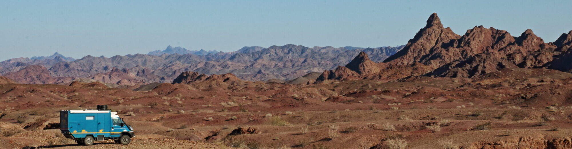
One of the great things about travel is you never stop learning. Just when you think you know a bit about geography and ‘what’s where’, you learn something new. Colombia is known for its jungle, mountains and coffee plantations (in addition to its drugs-barons and banditos obviously) but in the south, just to the north of San Agustín, it has a desert too! Who knew???

The Tatacoa Desert is not vast but it’s very scenic and, as deserts tend to be, it’s hot. Full of interesting rock formations and lots of cacti. Driving off down a side-track into the wilds, it’s a beautiful and peaceful place to celebrate a birthday (and yes, I did eat most of my chocolate/almond nougat ‘cake’ myself 😊). Still no sign of the drugs barons and banditos though. Maybe we’ll find them further north…
Link to next blog: Cool Colombia Link to full South America Blog
South Colombia Gallery


